


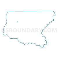
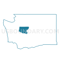
Roanoke Voting District, King County, Washington
About
Outline

Summary
| Unique Area Identifier | 686757 |
| Name | Roanoke Voting District |
| County | King County |
| State | Washington |
| Area (square miles) | 0.19 |
| Land Area (square miles) | 0.19 |
| Water Area (square miles) | 0.00 |
| % of Land Area | 100.00 |
| % of Water Area | 0.00 |
| Latitude of the Internal Point | 47.57416400 |
| Longtitude of the Internal Point | -122.13091000 |
Maps

Graphs
Select a template below for downloading or customizing gragh for Roanoke Voting District, King County, Washington


Neighbors
Neighoring Voting District (by Name) Neighboring Voting District on the Map
- BEL 41-2447 Voting District, King County, WA
- BEL 41-2970 Voting District, King County, WA
- BEL 41-3501 Voting District, King County, WA
- BEL 48-0177 Voting District, King County, WA
- BEL 48-0694 Voting District, King County, WA
- Eastmont Voting District, King County, WA
- Horizon Voting District, King County, WA
Top 10 Neighboring County Subdivision (by Population) Neighboring County Subdivision on the Map
Top 10 Neighboring Place (by Population) Neighboring Place on the Map
Top 10 Neighboring Unified School District (by Population) Neighboring Unified School District on the Map
Top 10 Neighboring State Legislative District Lower Chamber (by Population) Neighboring State Legislative District Lower Chamber on the Map
Top 10 Neighboring State Legislative District Upper Chamber (by Population) Neighboring State Legislative District Upper Chamber on the Map
Top 10 Neighboring 111th Congressional District (by Population) Neighboring 111th Congressional District on the Map
Top 10 Neighboring Census Tract (by Population) Neighboring Census Tract on the Map
- Census Tract 250.03, King County, WA (6,817)
- Census Tract 248, King County, WA (5,668)
- Census Tract 234.03, King County, WA (3,888)
- Census Tract 249.02, King County, WA (3,795)